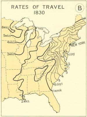
Check out the map at right. It shows how long it took to travel from New York City to various parts of the eastern U.S. – in 1830. Looks like about three weeks to Chicago! But you could get anywhere in New Jersey in just a day (though why would you want to?).
This article has several such maps, for dates ranging from 1800 to 1930. Fascinating stuff!


No comments:
Post a Comment