 I've written several times about the HiRISE camera system on the Mars Reconnaissance Orbiter robotic explorer that's orbiting Mars. The photo at right (click to enlarge) is one that it took recently. There are thousands of photos like this on the HiRISE web site, available for all to peruse. I have spent hours just staring at the amazingly detailed views of Mars – a destination that seemed so exotic and impossible when I was a kid, and now our robotic emissaries are exploring it almost routinely.
In this one photo you can see fantastical terracing (through wind erosion, I presume), sand dunes on the bottoms of the old craters, and a small, fresh crater (bluish gray in the lower left) with ejecta splashed on the surrounding terrain. Strange bumps and valleys dot the landscape. In a few places you can see tracks from falling boulders or perhaps landslides. The terrain on Mars is much more varied than I'd have guessed – if you look at a few dozen HiRISE photos, you'll see what I mean – there's little commonality from one area to another...
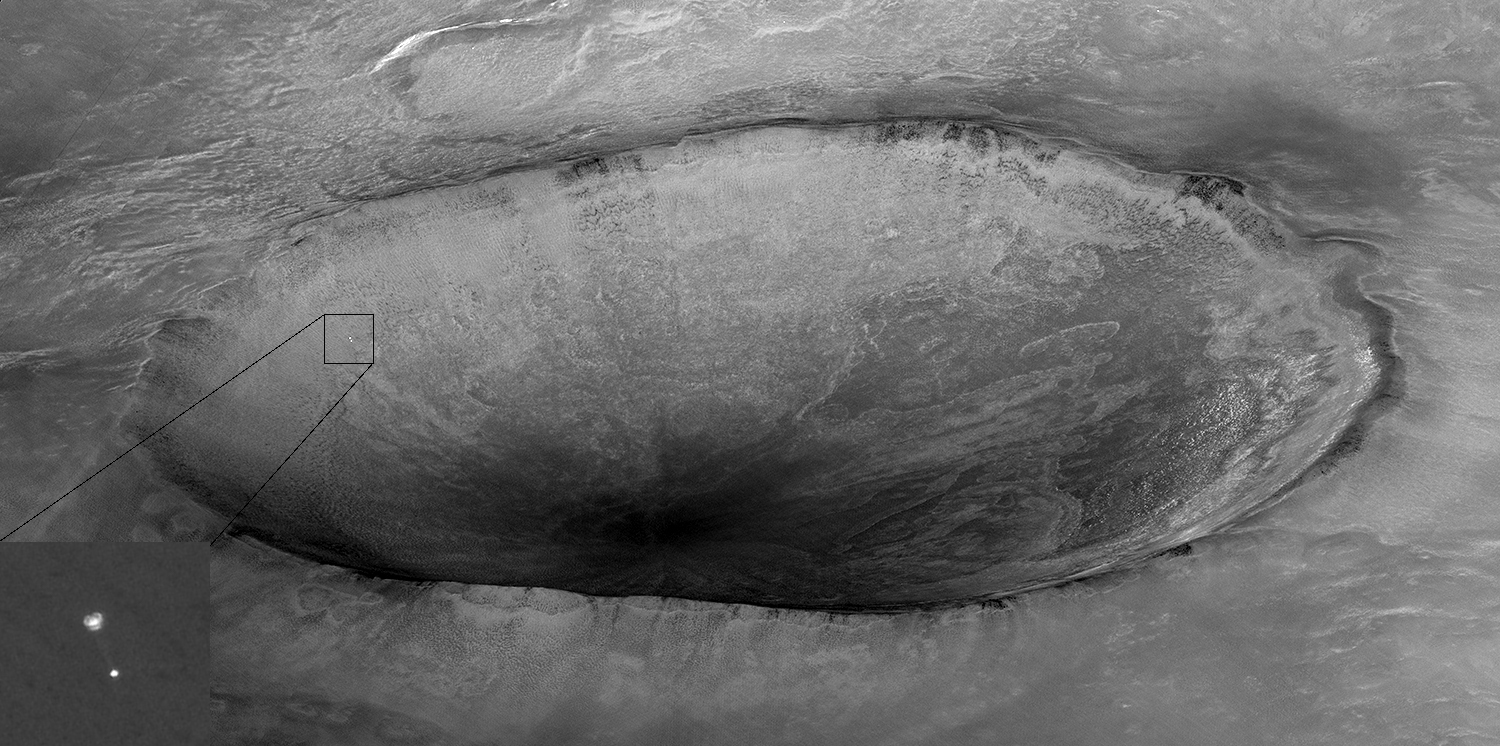
 The photo at right is also by HiRISE, but of a very different kind than it usually takes. First, the “look angle” is very oblique – normally HiRISE looks almost straight down at the surface. The purpose for this oblique look is also unusual: the researchers were trying to capture the Phoenix Lander while it was still in the atmosphere, under its parachute, headed for its landing – and they succeeded! Click to enlarge the photo to see what I mean...

No comments:
Post a Comment